

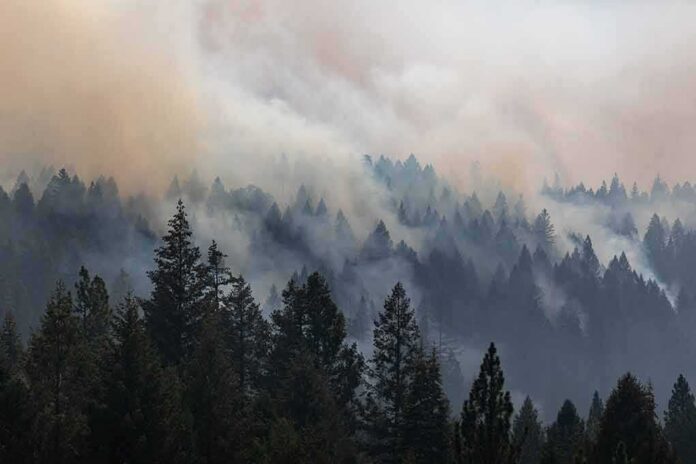
A fast-moving wildfire near New Hogan Lake jumped from a roadside blaze to thousands of acres in hours, forcing families to flee as officials raced to stay ahead of the flames.
Story Snapshot
- The Gann Fire started Monday evening near Hogan Dam Road and Gann Road and quickly grew from hundreds to several thousand acres with no containment.
- Mandatory evacuations now cover multiple zones east of Rancho Calaveras, with added areas as the fire expanded and spotting risks grew.
- Dry brush, steep terrain, and hot, windy weather are driving rapid spread, putting homes, roads, and local schools under threat.
- Emergency shelters for people and animals are open, while smoke from the fire worsens air quality across parts of Northern California.
Fast Spread From Roadside Ignition To Regional Threat
The Gann Fire began around 5:27 p.m. Monday near Hogan Dam Road and Gann Road in Valley Springs, just south of New Hogan Lake in Calaveras County. Cal Fire’s incident page described the blaze almost immediately as burning at a “dangerous rate of spread through grass and brush” with rapid uphill fire behavior, a warning that signaled trouble for nearby neighborhoods. Within a few hours, the fire grew from roughly 100–300 acres to over 1,400 acres, then 1,800 acres by early Tuesday.
Cal Fire and local outlets reported that by about 2 a.m. Tuesday the fire had already reached 1,800 acres and was still 0% contained. Later Tuesday morning, updates showed growth to around 2,100 acres, and by late morning and early afternoon, incident reports and media coverage placed the size near 3,700 acres, with some estimates climbing toward 6,500 acres as mapping caught up. These jumps reflect both real spread and better perimeter data, but they underline how quickly one ignition can become a regional crisis.
Evacuation Zones Expand As Officials Chase Moving Danger
As the fire grew Monday night, Calaveras County Sheriff’s Office and Cal Fire issued mandatory evacuation orders for zones CCU-109, CCU-110, CCU-139, and CCU-147, covering areas east of Rancho Calaveras and near Valley Springs and New Hogan Lake. Orders began around 8:18 p.m., when the fire crossed about 300 acres, showing officials were willing to act before flames reached every home. These zones match mapped corridors where roads could clog, and where steep slopes and brush make escape harder once the fire pushes uphill.
By early Tuesday afternoon, Cal Fire’s incident update showed a wider evacuation footprint, including CCU-130-B and CCU-140 under evacuation orders, and several warning zones like CCU-111 and CCU-153 on alert. This shift from four zones to a broader ring of orders and warnings came as the fire’s size passed 3,700 acres and officials warned embers could travel up to three miles, starting spot fires ahead of the main front. That risk makes waiting for visible flames at the property line a gamble that many residents, on both left and right, no longer trust government to manage well.
Dry Fuels, Steep Hills, And Smoke Show Systemic Strains
Cal Fire officials and reporters pointed to bone-dry grass and brush, rugged terrain south of New Hogan Lake, and hot, windy weather as the main drivers of the Gann Fire’s fast growth. Crews described brush so dry it could be broken by hand, a sign of long-term stress in the landscape that many Americans link to years of firefighting on one hand and policy gridlock on the other. Firefighters are battling on slopes and canyons where aircraft drops and bulldozer lines are hard to place, slowing the fight even as the fire runs.
𝐃𝐞𝐩𝐮𝐭𝐢𝐞𝐬 𝐀𝐬𝐬𝐢𝐬𝐭 𝐚𝐭 𝐂𝐚𝐥𝐚𝐯𝐞𝐫𝐚𝐬 𝐂𝐨𝐮𝐧𝐭𝐲 𝐅𝐢𝐫𝐞
The Placer County Sheriff’s Office has deployed deputies to assist the Calaveras County Sheriff’s Office as they respond to the Gann Fire, burning just south of New Hogan Lake.The fire has grown to more… pic.twitter.com/VhYlngjfSc
— Placer Sheriff (@PlacerSheriff) August 5, 2026
To support evacuees, officials opened the Valley Springs Veterans Memorial Hall as a shelter for people and small pets and designated the Calaveras County Fairgrounds for livestock and large animals. Even as no structures were reported damaged in some early updates, homes were later shown burned and schools in the Calaveras Unified district canceled classes due to smoke and shifting winds. Smoke spread into other counties, cutting visibility and hitting air quality, which pulled in attention from far beyond the immediate fire zone.
Information Gaps And Growing Public Doubt
Coverage of the Gann Fire shows a familiar pattern: fast-changing facts, urgent headlines, and limited public access to the detailed maps and written orders behind each evacuation decision. Cal Fire and the sheriff share updates through incident pages, social posts, and briefings, while news outlets repeat key phrases like “fast-moving,” “no containment,” and “evacuation zones expand.” This helps people know to leave, but it also leaves many wondering how, exactly, officials weighed the danger to their street versus another one down the road.
For Americans who already feel the system serves elites first, those gaps feed a wider frustration. Residents see billions spent on agencies and programs, yet a single roadside fire can still threaten thousands of acres, shut schools, and force hurried escapes on crowded roads. The Gann Fire response shows dedicated firefighters working through the night, opening shelters, and warning about ember spread — but it also highlights how hard it is for regular people to get clear, zone-level answers while the emergency is unfolding.
Sources:
nypost.com, sfchronicle.com, sfgate.com, youtube.com, kcra.com, cbsnews.com, fire.ca.gov, kioncentralcoast.com, mymotherlode.com, facebook.com